Kilimanjaro climb Machame route – 6 Days
Mount Kilimanjaro Routes
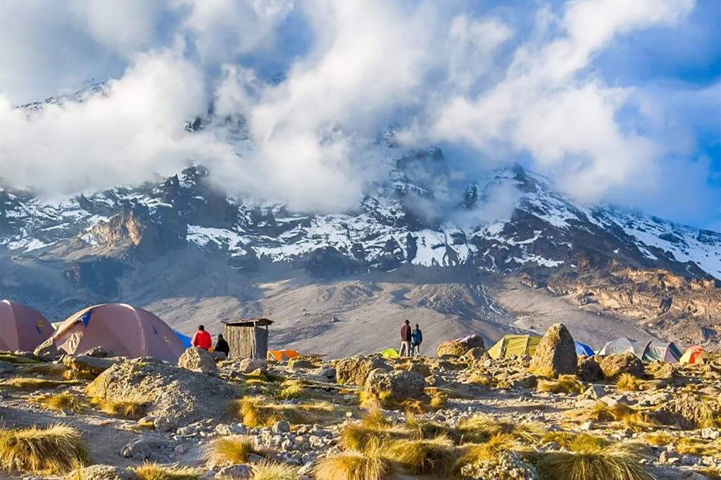
description for Kilimanjaro climb Machame route – 6 Days
The Machame path is without a doubt the busiest on the mountain because to its high success rate and attractiveness. You have a tremendous adventure ahead of you over the next seven days, with a good probability of summiting.
With an approach to the south west of the mountain, the ascent begins at Machame Gate, at a height of 1800 meters. On the first day, it travels through beautiful rainforest before continuing up the mountain to Shira Camp, where the Lemosho route connects from the west. From here, ascend the Great Barranco Wall on your way to Barafu Camp, then travel the southern side of the mountain to Barranco via Lava Tower. Rather than retracing your steps along the climbing route, you will descend via the Mweka trail after reaching the peak.
The Machame path is known as the “Whiskey Route” because it is regarded more difficult than the Marangu route, which is known as the “Coca Cola Route.” In actuality, it is not technically more difficult, but it is longer and steeper in some spots. The greater distance and ability to ‘walk high, sleep low’ allows for significantly better acclimatization and, as a result, a high success rate.
The Machame route is a suitable seven-day climb for those who haven’t hiked much at high elevations before, as it allows for an extra day of acclimatization and hence a higher success rate. Mountaineers with prior experience and acclimatization may choose the more arduous Machame route, which takes six days to complete.
explore day by day
DAY ONE
ARUSHA TO MACHAME GATE (1,634 M/5,363 FT.) TO MACHAME CAMP (2,834 M/9300 FT.)
Hike time: 7.5 hrs. Elevation change: +1,200 m/+3,937 ft. estimated distance: 10km/6.21 miles Final elevation: 3100 m/10,170 ft. Your day starts early with a briefing, followed by breakfast and about 1 hour 45 minutes drive from Arusha to Machame Gate. The guides and porters prepare and pack the supplies and your equipment in the village. You will receive a lunch pack and after registering at the gate office, you start your ascent and enter the rain forest almost immediately. Dinner and overnight at the camp.
DAY TWO
MACHAME CAMP (2,834 M/9,300 FT.) TO SHIRA CAMP (3,749 M/12,300 FT.)
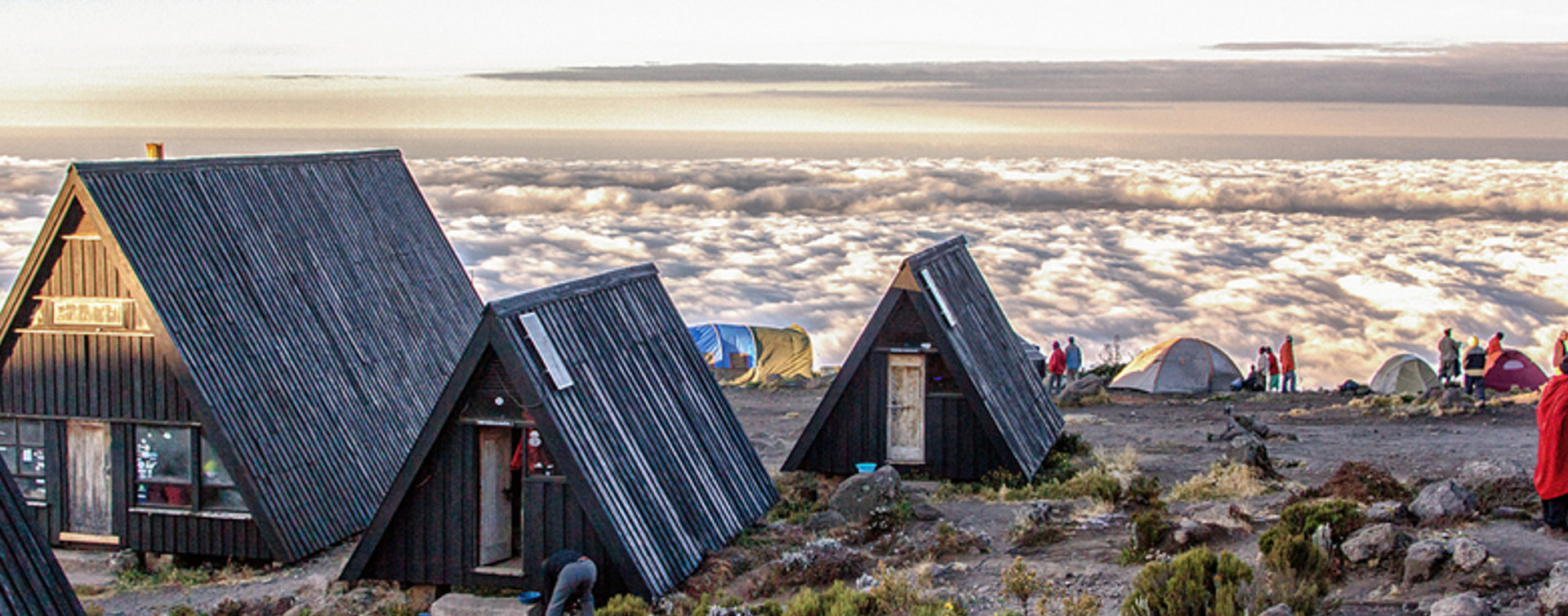
Hike time: 7 hrs. Elevation change: +800 m/+3,000 ft. estimated distance: 6km/3.75 miles Final elevation: 3,800 m/12,467 ft. You rise early at Machame camp and after breakfast you climb an hour or so to the top of the forest and then for 2 hours at a gentler gradient through the moorland zone. After a short lunch and rest, you continue up a rocky ridge onto the Shira plateau. By now you will be able to see in an easterly direction, the Western Breach with its stunning glaciers. You are now due west of Kibo and after a short hike you will reach the Shira campsite at 3840m. The porters will boil drinking and washing water, before serving dinner. The night at this exposed camp will even be colder than the previous night, with temperature dropping to well below freezing.
DAY THREE
SHIRA CAMP (3,749 M/12,300 FT.) TO LAVA TOWER (4630 M) TO BARRANCO CAMP (3,901 M/12,800 FT.)
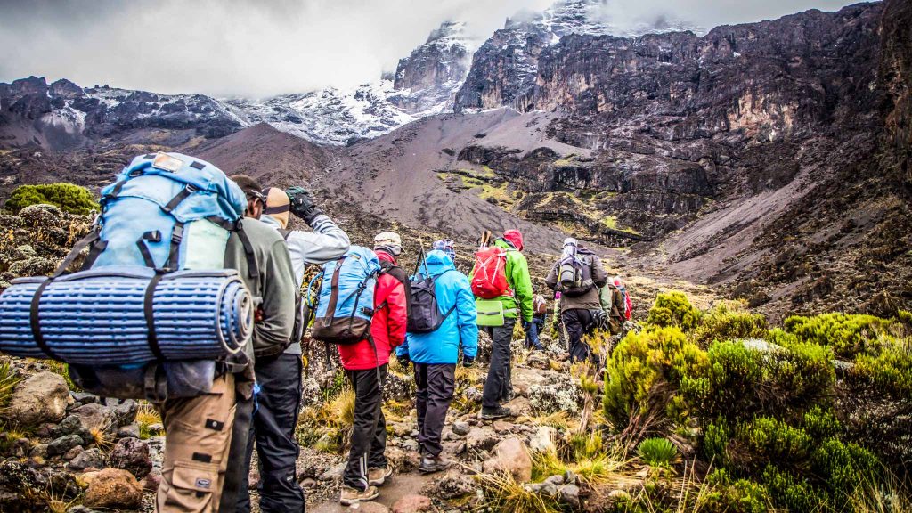
Hike time: 5 hrs. Elevation change: +100 m/+328 ft. Estimated distance? Final elevation: 3,900 m/12,800 ft. The route now turns east into a semi desert and rocky landscape surrounding Lava Tower, where you reach an altitude of 4630m after about a 5 hours walk. Lunch is served in a designated are before ascending the rocky scree path to lava Tower (4630m). Definitely, the toughest day so far. It is normally around this point, where for the first time, some climbers will start to feel symptoms of breathlessness, irritability and headaches. After lunch you descent again by almost 680m to the Barranco camping area and after reaching the high altitude of 4600m at Lava Tower, the true acclimatization benefit of this day becomes clear. This descent to Barranco camp takes about 2 hrs. And offers great opportunities to take some beautiful photographs of the Western Breach and Breach wall. The camp is situated in a valley below the Breach and Great Barranco wall, which should provide you with a
DAY FOUR
BARRANCO CAMP (3,900 M/12,800 FT.) TO BARAFU CAMP (4,600 M/15,091 FT.)
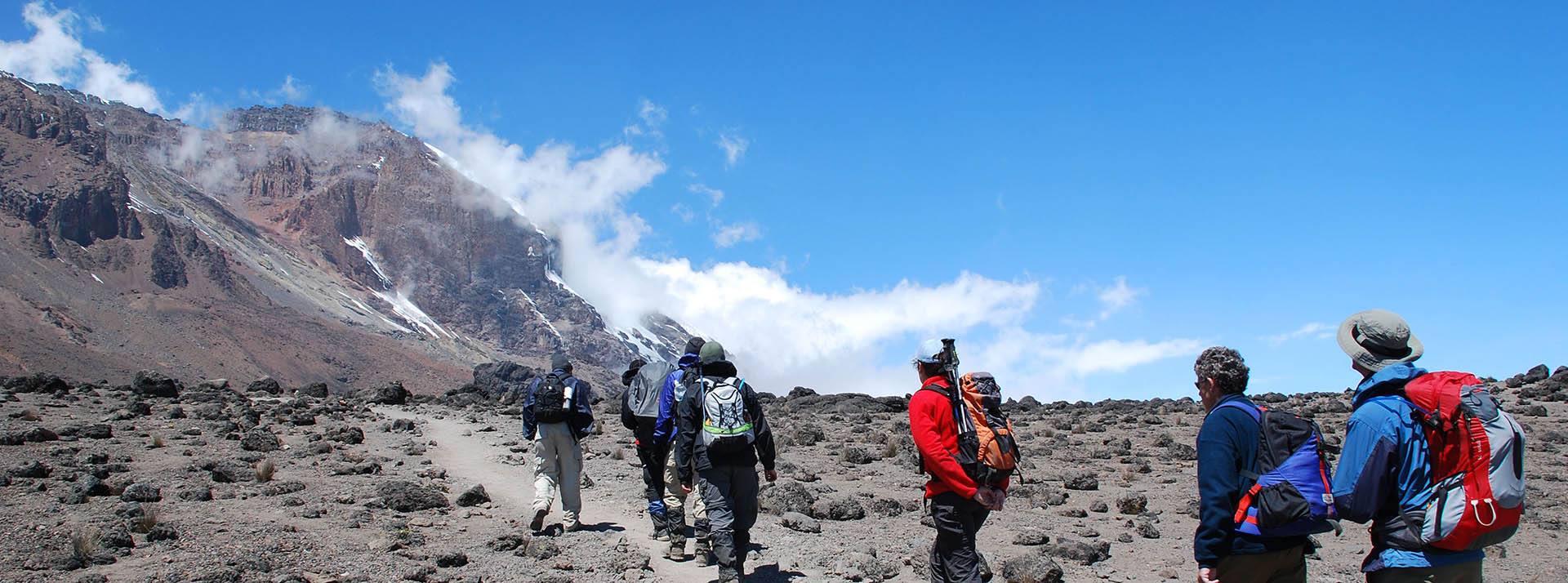
Hike time: 3.5 hrs. Elevation change: +100 m/+328 ft. Estimated distance: 4km/2.5 miles Final elevation: 3,963 m/13,000 ft. You climb the Great Barranco Wall, which looks more intimidating than it really is, and down into the Karanga Valley. This day has many ups and downs and crosses many small streams before crossing the Karanga River just before camp.
DAY FIVE
SUMMIT ATTEMPT, BARAFU CAMP (4,600 M/15,091 FT.) TO UHURU PEAK (5,895 M/19,343 FT.) TO MWEKA CAMP (3,100 M/10,170 FT.)
Hike time: 3.5 hrs. Elevation change: +600 m/+1,968 ft. Estimated distance: 4km/2.5 miles Final elevation: 4,600 m/15,091 ft. Today the route moves through rocky and otherwise barren terrain on your way to Barafu Camp. The camp is in another cold and windy area, but you’ll only be sleeping from around 7 p.m. until 11: 30 p.m. or so thanks to the summit climb commencing at midnight.
DAY SIX
SUMMIT ATTEMPT, BARAFU CAMP (4,600 M/15,091 FT.) TO UHURU PEAK (5,895 M/19,343 FT.) TO MWEKA CAMP (3,100 M/10,170 FT.)
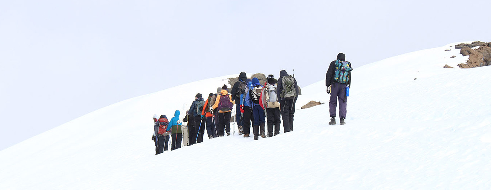
Summit time: 7 hrs. Elevation change: +1,300 m/+4,265 ft. Estimated distance: 5km/3.2 miles Final elevation: 5,896 m/19,343 ft. Descent time: 5 hrs. Elevation change: -2,800 m/-9,186 ft. Estimated distance: 12km/7.5 miles Final elevation: 3,100 m, 10,170 ft. Today kicks off at midnight with by far the most challenging 6-hour section of entire climb as you reach Stella Point around sunrise. After a short rest you’ll probably be walking in snow for the next two hours until you reach Uhuru Peak, AKA the summit! After enjoying the moment briefly you will begin your descent to the Mweka Camp back under cover of the cloud forest, about and 8 hour trek including a quick rest midway.
DAY SEVEN
MWEKA CAMP (3,100 M/10,170 FT.) TO MWEKA GATE (1,828 M/6,000 FT.) -ARUSHA
Descent time: 4 hrs. Elevation change: -1,250 m/-4,101 ft. Estimated distance: 10km/6.21 Final elevation: 1,828 m/6,000 ft. After an early and well-deserved breakfast, it is a short 3-hour and scenic hike back to the Park gate. At Mweka gate you sign your name and details in a register. This is also where successful climbers receive their summit certificates. Those climbers who reached Stella Point (5685m) are issued with green certificates and those who reached Uhuru Peak (5895m) receive gold certificates. Africa Moja Safaris & Adventures Vehicles will be waiting at Mweka Gate to take you back to Arusha in our affiliated Hotels.
- all accommodation as per itinerary
- 4X4 safari vehicle & Fuel
- Full time English speaking driver/ guide
- All meals as indicated
- Park entrance fees
- Boat cruises
- Vehicle entrance fees
- Bottled mineral water while
- on safari
- All activities as indicated
- Tips
- Visa fees
- Air tickets
- All items of personal nature like laundry, phone calls, beer, e.t.c
Enquire This Tour
Fill in you details below and submit the form. You will be contacted by your designated safari expert with the best proposal.